|
| *****SWAAG_ID***** | 258 |
| Date Entered | 01/08/2011 |
| Updated on | 01/08/2011 |
| Recorded by | Tim Laurie |
| Category | Enclosure |
| Record Type | Archaeology |
| Site Access | Public Footpath |
| Record Date | 01/01/2005 |
| Location | Aysgarth. Flout Moor Lane. |
| Civil Parish | Aysgarth |
| Brit. National Grid | SD 982 873 |
| Altitude | 309m |
| Geology | Drumlin like boulder clay ridge. |
| Record Name | Castle Dikes Henge. |
| Record Description | Single entrance henge.
This is a classic henge comprising central featureless area enclosed by a ditch and outer bank.
The single entrance is on the eastern perimeter, all other gaps are recent drainage trenches.
Various large rocks in the pastures to the east of the henge may simply be sheep rubbing stones, but could conceivably be the remnant of some structure possibly associated with the henge. |
| Dimensions | See photos. |
| Additional Notes | Castle Dikes Henge is the only real henge monument on the NE Pennine Fringe.
Castle Dikes should be considered as being one element within a contemporary later neolithic/Early Bronze Age Landscape which included the oval cairn known as Stoney raise on Geenber Edge, the decorated round cairn on Addlebrough, round cairn on Counterset Crag, occupation sites and the numerous burnt mounds (indicators of contemporary Late Neolithic and Bronze Age Settlement) in the vicinity of Semerwater, on the eastern slopes below Addlebrough,on Thornton Rust Moor and at Haw bank Springs. The two large burnt mounds at Haw Bank Springs are just 700m to the west of Castle Dikes Henge and are visible from the Henge.
The single entrance is to the east. Otheer gaps in the ditch and outer bank are recent field drainage trenches.
Castle Dikes henge is a Scheduled Ancient Monument and has not been excavated. It is likely to be of Late Neolithic Age. |
| Image 1 ID | 910 Click image to enlarge |
| Image 1 Description | AP of the Henge known as Castle Dikes, Aysgarth. (Photo St Joseph, J.K.S.) | 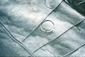 |
| Image 2 ID | 911 Click image to enlarge |
| Image 2 Description | Castle Dikes Henge. Winter. | 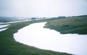 |
| Image 3 ID | 912 Click image to enlarge |
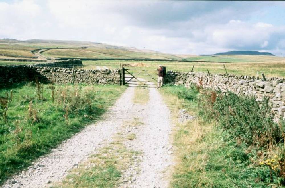
| Image 3 Description | Flout Moor lane. the approach to Castle Dikes Henge. |  |
| Image 4 ID | 913 Click image to enlarge |
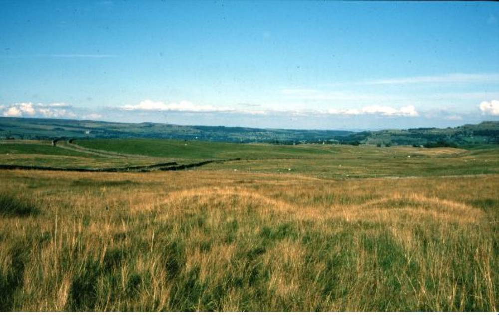
| Image 4 Description | Burnt Mound, one of two large burnt mounds located just 700m West of Castle Dikes Henge. The henge is visible in the mid distance from this burnt mound. |  |